CLICK HERE FOR APPLICATION INFORMATION


PARK LOCATION & DESCRIPTION
Beckley Creek Park is one of Louisville's newest parks and is the first of the planned park areas to be completed by 21st Century Parks. Beckley Creek Park is one of the most traditional, formally designed parks in the 21st Century Parks system – the topography in this area lends itself well to wide open lawns, perfect for event lawns and sports activities. The Barklands of Floyds Fork is tucked in between The Egg Lawn and I-64 on approximately 4 acres of land. The area is divided into three areas: Small Dog, All Dog and a resting area, which will be rotated frequently.

"Before visiting The Barklands of Beckley Creek Park after or during a rain event, please check http://www.theparklands.org/Parks/Beckley-Creek-Park/9/The-Barklands-Beckley-Creek-Park where a notification of closure will be posted."


DIRECTIONS
From I-64 = Take EXIT 19B to the GENE SNYDER FREEWAY NORTH. You will then want to take EXIT 27 for SHELBYVILLE ROAD and go EAST. You will go about one mile and take a RIGHT onto SOUTH BECKLEY STATION ROAD. Go under I-64 and you will see the entrance to Beckley Creek Road and The Barklands of Floyds Fork on your left.


PARK LOCATION & DESCRIPTION
Champions Park is a new park along the River Road Recreation Corridor that includes the former Louisville Soccer Park, the Frankfort Avenue Landfill and the former River Road Country Club site. The Champions Dog Run is the first facility in this new park and spreads out over 3.6 acres of the former golf course. There are separate All Dog and Small Dog sides, drinking water available, and plenty of space to run around and exercise.


DIRECTIONS
From I-71 = Take EXIT 2 and turn north onto ZORN AVENUE. The entrance to the parking area for the dog run will be located on your immediate left. If you get to River Road you've gone too far.


PARK LOCATION & DESCRIPTION
Cherokee Park is a 409-acre park located in the heart of Louisville. 
The Cochran Hill Dog Run in Cherokee Park is located on a portion of Cherokee Park between I-64 and Lexington Road at the northern end of the park. The area is approximately three acres and is divided to allow one side for all dog use and one side for small dog use. To see the layout of the site please go to http://louisvilledogs.netfirms.com/cherokee.pdf.


DIRECTIONS
From I-64 = Take EXIT 8 and turn south onto GRINSTEAD DRIVE. Go down GRINSTEAD DRIVE and take a left onto LEXINGTON ROAD. Go about half a mile and take a right onto COCHRAN HILL ROAD (first road on your right after you go under I-64). The dog park is located immediately to your right.

From Bardstown Road = Turn east onto EASTERN PARKWAY. Take EASTERN PARKWAY into Cherokee Park and onto the SCENIC LOOP. Follow the SCENIC LOOP around past the archery range and take a right onto COCHRAN HILL ROAD (on your right just before you get to the rugby field). Go to the top of the hill, past the maintenance building, and the dog park will be on your left.


PARK LOCATION & DESCRIPTION
Wendell Moore Park is a 107-acre park located in the center of Oldham County, just north of the intersection of KY 146 and KY 393 in the Buckner community. The LDRA is very happy to partner up with Oldham County Parks & Recreation to bring Oldham County residents their first official off-leash dog park. The dog park is approximately 2 acres and is located south of the Oldham County Dispatch building across from the softball fields.


DIRECTIONS
From KY 146 = Turn NORTH onto KY 393 (next to Oldham County High School). Go approxiamately 0.75 mile north and turn onto DISPATCH WAY (it will be the third road on your right after you get on KY 393). Wind your way back and the dog park will be on your left.


PARK LOCATION & DESCRIPTION
Toonerville Trolley Park is a 2-acre park located in the heart of the Old Louisville Neighborhood at the intersection of Oak Street and Brook Street. The Louisville Dog Run Association, Toonerville Trolley Neighborhood Association, and Louisville Metro Parks worked together to establish the Old Louisville Dog Run. The dog run consists of two 100' x 115' areas, one built over the old tennis court and the other on the grassy area at the back of the park.


DIRECTIONS
From I-65 = Take EXIT 135 and go west on ST. CATHERINE STREET. Turn south onto FIRST STREET and then take a left onto OAK STREET. The park is located on the southeast corner of the intersection of OAK and BROOK STREETS.


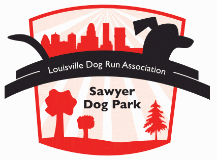
PARK LOCATION & DESCRIPTION
E.P. "Tom" Sawyer State Park is a 369-acre park located in eastern Louisville Metro. On Saturday, April 10, 2004, the Louisville Dog Run Association and Kentucky Department of Parks opened the Sawyer Dog Park. Sawyer Dog Park was the first official off-leash dog park in our community.

Sawyer Dog Park is located in the northeast corner of the park property across Freys Hill Road from the main park entrance. The park spans across approximately six acres and is divided into three two-acre areas: one for small dogs (dogs under 30 pounds) and two for all dogs.


DIRECTIONS
From I-64 = Take EXIT 19 to northbound Gene Snyder Freeway. Follow the Gene Snyder Freeway to EXIT 32 and turn right at the end of the ramp onto WESTPORT ROAD. Go approximately 0.75 miles and take a left onto FREYS HILL ROAD. Go approximately 0.4 miles and turn left onto the small road just before you get to the E.P. "Tom" Sawyer State Park entrance. Follow the road back to the dog park.

From I-71 = Take EXIT 9-A to southbound Gene Snyder Freeway. Follow the Gene Snyder Freeway to EXIT 32 and turn right at the end of the ramp onto WESTPORT ROAD. Go approximately 0.75 miles and take a left onto FREYS HILL ROAD. Go approximately 0.4 miles and turn left onto the small road just before you get to the E.P. "Tom" Sawyer State Park entrance. Follow the road back to the dog park.

From Hurstbourne Parkway = If you are traveling north on Hurstbourne, take a right onto WESTPORT (if you are going south, you'll take a left onto WESTPORT ROAD). Go to the first stop light and take a right onto FREYS HILL ROAD. Go approximately 0.4 miles and turn left onto the small road just before you get to the E.P. "Tom" Sawyer State Park entrance. Follow the road back to the dog park.


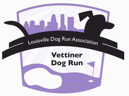
PARK LOCATION & DESCRIPTION
Charlie Vettiner Park is a 283-acre park located in southeastern Louisville Metro. The Louisville Dog Run Association and Louisville Metro Parks have worked together to open the Vettiner Dog Run.

The Vettiner Dog Run is located behind the tennis courts along the southern boundary of the park. The dog run is approximately two acres and is divided in half to allow one side for all dog use and one side for small dog use. The area is located at the high point of the park, offering a wonderful view of the Vettiner Park and surrounding area.


DIRECTIONS
From the Snyder Freeway = Take EXIT 19 and turn north onto BILLTOWN ROAD. Go approximately two miles and take a right onto MARY DELL ROAD (at the flashing yellow light). Go to the entrance into Charlie Vettiner Park and go straight through the "YIELD" sign. Follow the road back to parking lot in front of the tennis courts. The dog run is located behind the tennis courts.

From Taylorsville Road = Turn south onto RUCKRIEGEL PARKWAY. Go approximately 0.5 miles and take a left onto BILLTOWN ROAD. Go approximately 1.7 miles and take a left onto MARY DELL ROAD (at the flashing yellow light). Go to the entrance into Charlie Vettiner Park and go straight through the "YIELD" sign. Follow the road back to parking lot in front of the tennis courts. The dog run is located behind the tennis courts.


PARK LOCATION & DESCRIPTION 
Waverly Park is a 297-acre park located in southwestern Louisville Metro. The Louisville Dog Run Association and Louisville Metro Parks have worked together to open the Waverly Dog Run. The Waverly Dog Run is located at the end of Waverly Park Road. The run is approximately an acre and a half and is not divided so there is only one area for all dogs. The area is past the lake area and is in the woods

 
DIRECTIONS 
From the Snyder Freeway = Take EXIT 6 and turn north onto New Cut Road. Go approximately .3 miles and take a left onto OUTER LOOP. Go .4 miles to 3rd STREET RD and turn left. Go .7 miles and turn right on to ARNOLDTOWN RD. Go 1.3 miles and turn left on to WAVERLY PARK RD and go to the end. 


 From Waterson Freeway = Take Exit 6 and go south on DIXIE HWY. Go approximately 14.7 miles and turn left on ST ANDREWS CHURCH RD. The road changes names across Dixie so be careful. Go 1 mile and turn right onto ARNOLDTOWN RD. Go 1 mile and WAVERLY PARK RD will be on the right. It’s right past a bend in the road so watch out for it. There is a large park sign. Go to the end of the road..


RULES
Before you join or visit, it is important that you thoroughly read and understand the LDRA's dog run rules. Please go to http://louisvilledogs.netfirms.com/rules.html for a complete list.


VISITING LOUISVILLE?
Are you and your dog planning on visiting Louisville? If you will be visiting or passing through Louisville please email us at info@louisvilledogs.com to find out how you and your four-legged traveling companion can have temporary access to the Cochran Hill Dog Run located in Cherokee Park. We do what we can to help give out-of-town visitors a place to allow their dogs to stretch their legs. All we ask is that you contact us before you come to town, make sure to bring your dog's vaccination records with you, and email us after you've visited the park to let us know what you think.


If you have any questions or want to receive our newsletter please contact us at info@louisvilledogs.com.


Louisville Dog Run Association 
P.O. Box 221611
Louisville, Kentucky 40252
502-867-9416
info@louisvilledogs.com